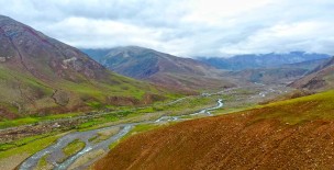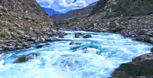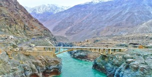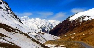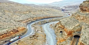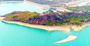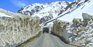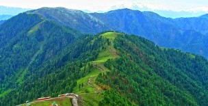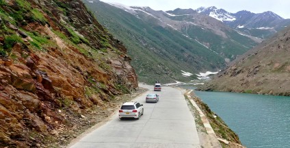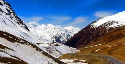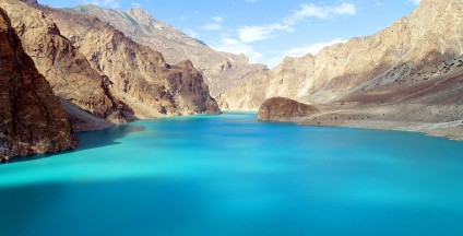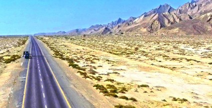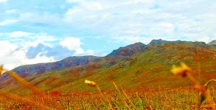
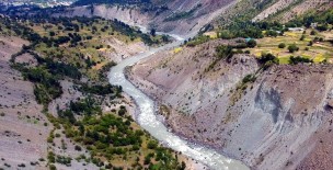
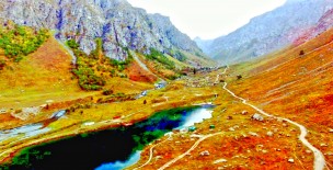
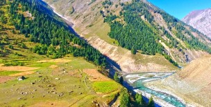
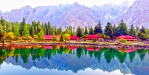

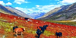
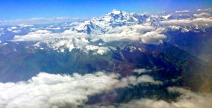
Hunza is situated at the bank of Hunza river in the northern part of Gilgit-Baltistan, Pakistan, bordering with Ishkoman to the northwest, Shigar to the southeast, Afghanistan's Wakhan Corridor to north, and the Xinjiang region of China to the northeast. Hunza is a mountainous valley in the Gilgit-Baltistan region of Pakistan at an elevation of 2,438 meters (7,999 feet). Several high peaks rise above 7,000 m in the surroundings of Hunza Valley. Rakaposhi 7,788m, Ultar Sar 7,388 m, Bojahagur Duanasir II 7,329 m), Diran peak 7,266m, Spantik 7027m, Ghenta Peak 7,090 m, Hunza Peak 6,270 m, Darmyani Peak 6,090 m, and Bublimating (Ladyfinger Peak) 6,000 m. On January 4, 2010, a landslide blocked the river and created Attabad Lake (also called Shishket Lake). The new lake extends 30 kilometers (19 mi) and rose to a depth of 400 feet (120 m) when it was formed. Ibex, Markhor, Snow leopards (if you are lucky) and Yak’s may be found on the way to Khunjerab pass. For anyone who is fond of driving, this is a must-drive road starting from Hunza all the way up to Khunjerab Pass. The scenery is breathtaking to say the least. The distance from Hunza to Khunjerab Pass is approximately 95 kilometers and the ride to the border takes about three and a half hours. Khunjerab Pass is a high mountain pass in the Karakoram Mountains. It is 4,693 meter (15,397 ft.) above sea level (oxygen is insufficient to breath hence please go prepared). The Khunjerab Pass is the highest-paved international border crossing in the world and the highest point on the Karakoram Highway. Weather can change suddenly so please ensure you take warm clothing along with you and enough fuel and other useful gear in case you experience heavy snowfall. At the Pakistan-China border, the Pakistani side features the highest ATM in the world, administered by the National Bank of Pakistan and 1LINK.
Gilgit Baltistan - Road from Hunza to Khunjerab
Related Videos
Leave a Comment:
For comment please login first: Login here